District DEIB Data
The provided data offers a comprehensive breakdown of the demographics among our faculty, staff, and students. This includes insights into faculty hiring and retention. The data collection process occurred during the 2022-2023 school year, facilitated by both the District Human Resources Department and the Massachusetts Department of Elementary and Secondary Education Annual Accountability Report.
Student, Faculty, and Support Staff Demographics
Student Demographics
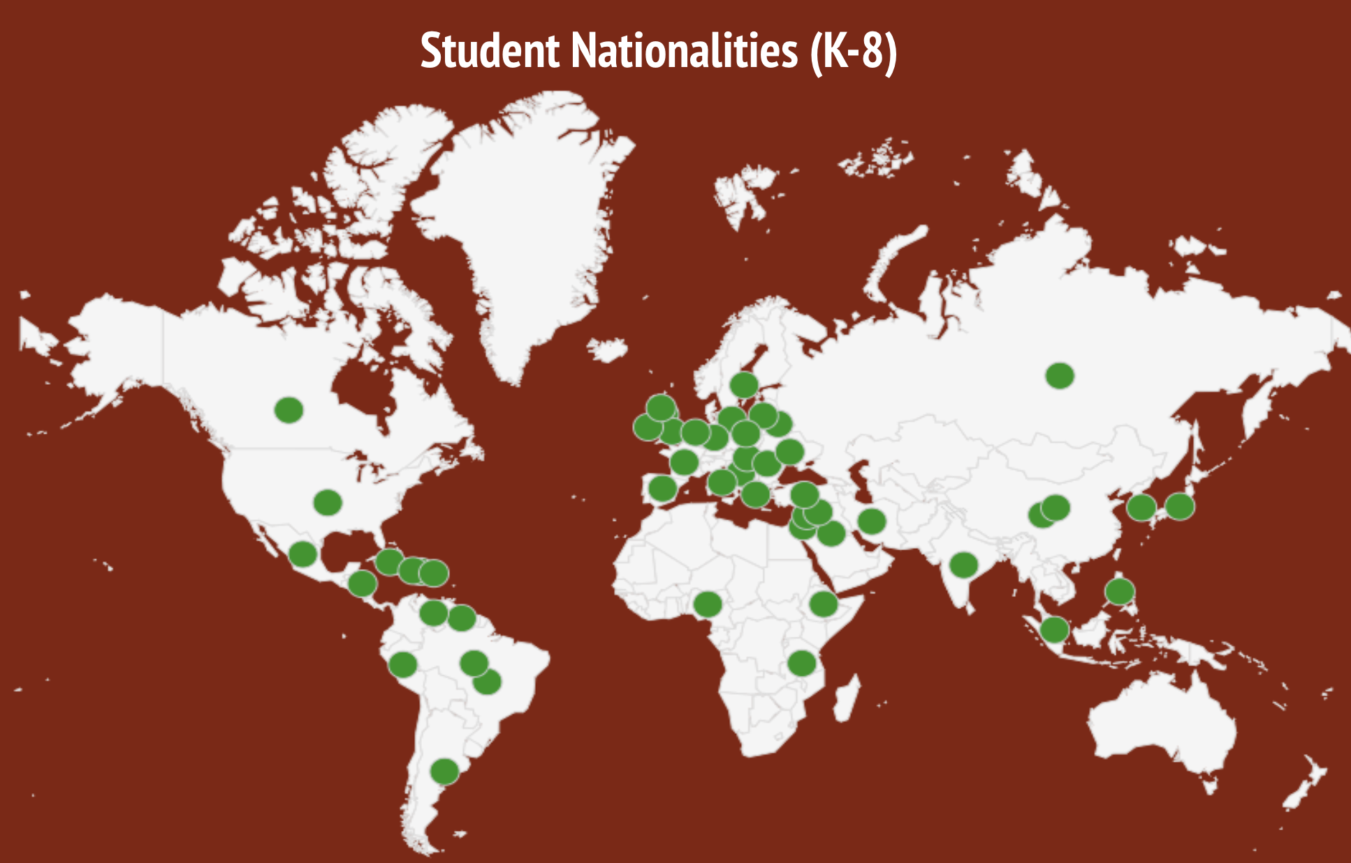
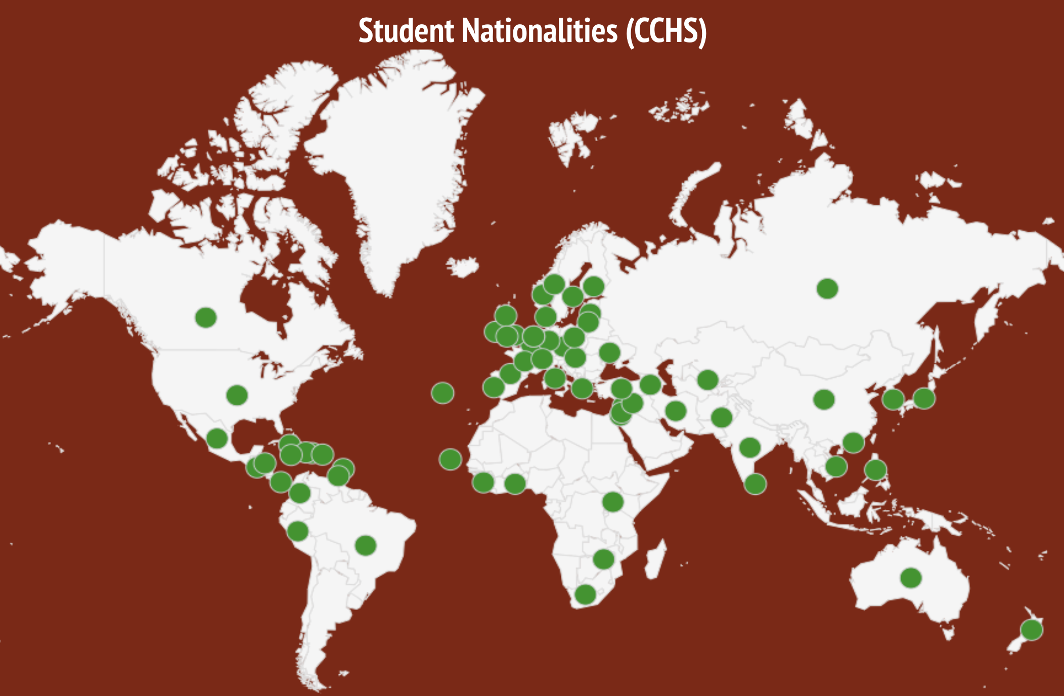
The nationality of a person is their place of birth. The nationalities of CPS and CCHS students were surveyed during the 2020- 2021 school year. Over 28 countries are represented within the student population at CPS, and over 70 countries at CCHS. Please note that this particular map, also known as the Mercator Map Projection, is an inaccurate illustration of countries like Africa (which is 14 times larger than Greenland) and Brazil (5 times larger than Alaska). Traditional maps have downplayed the size of the African continent in comparison to other parts of the world.
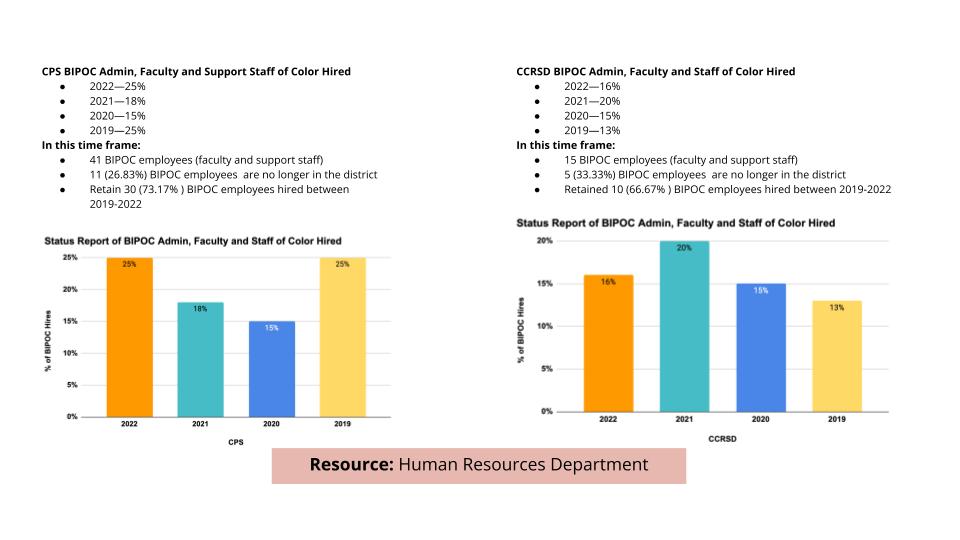
Hiring and Retention
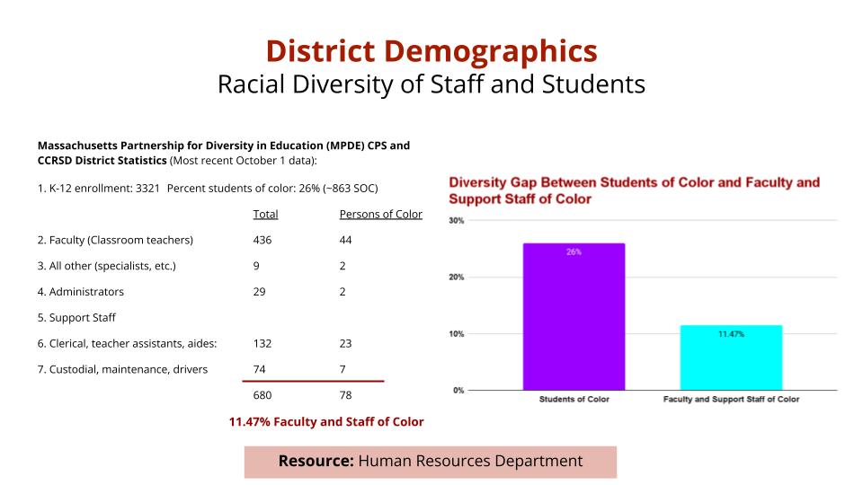
Concord Public Schools and Concord-Carlisle Regional School District have a strategic initiative to recruit, hire, mentor, and retain a more racially and ethnically diverse faculty and staff. We continue to adjust our hiring practices to address the diversity gap between our students of color and their teachers and support staff of color. We have underscored the urgency to amplify the need for teacher and staff diversification in the district so that effective teaching and learning meet all students’ diverse needs, especially faculty, staff, and students of color.
Supporting Our Educators of Color
In the 2020-21 school year, we updated the School Committee on our District hiring efforts. Qualitative data (focused on the experiences of our Educators of Color across our elementary, middle, and high schools) was gathered through a focus group. Our discussions revealed how our Educators of Color need an affinity group and space to gather and share their experiences and discuss effective classroom management practices. The Educators of Color Affinity Mentor Group was established as a direct result of the focus group. The primary goals of the Affinity Mentor Group are to support the professional growth of new Educators of Color in the District; address unique needs and challenges that Educators of Color encounter as they get acclimated to their school culture and establish working relationships with colleagues; and connect with other Educators of Color new to the District through the PreK-12 BIPOC Affinity Group staff Gatherings to build a greater sense of connection and belonging through shared experiences.
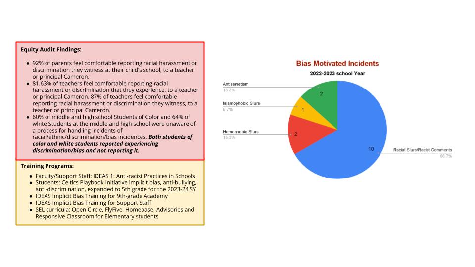
Bias Motivated Incidents